Chinese Embassy Calls Claims of No Early Warning on Rasuwa Flood ‘Fake News’

Dragon Media Correspondent
The Chinese Embassy in Kathmandu has rejected as “fake news” claims that China failed to provide Nepal with an early warning before the devastating Bhote Koshi flood in Rasuwa and that the disaster was caused by the collapse of a natural geological dam on the Chinese side of the border.
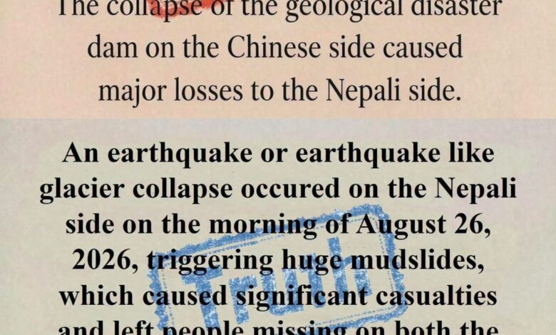
In a post on its official social media account, the embassy specifically challenged two claims: that “China did not issue an early warning to the Nepali side, resulting in significant casualties,” and that “the collapse of a geological disaster dam on the Chinese side caused major losses to Nepal.”
Instead, the embassy stated that on the morning of August 26, an earthquake or an earthquake-like glacier collapse occurred on the Nepali side, triggering massive landslides and debris flows that caused significant casualties and left people missing on both sides of the Gyirong–Rasuwagadhi border region.
The embassy concluded its message with the statement: “Accusation helps nothing. Cooperation saves lives.”
However, the exact geographical origin of the disaster and questions surrounding early warning have not yet been conclusively established. Preliminary scientific assessments indicate that a massive collapse involving ice, rock and glacial material occurred in the high Himalayan region, generating an exceptionally powerful debris flow.
Some initial assessments have suggested that the source of the collapse may have been in the high-altitude area on the Chinese side of the border, while the Chinese Embassy has maintained that the triggering event occurred on the Nepali side. The two accounts therefore differ on an important question that requires further scientific verification.
There has also been no conclusive evidence so far that a major tectonic earthquake triggered the disaster. One scientific interpretation is that seismic signals detected around the time of the event may have been generated by the enormous collapse of ice and rock itself. It would therefore be premature to classify the event definitively as an ordinary monsoon flood, a glacial lake outburst flood or an earthquake-triggered disaster.
The early-warning issue is equally sensitive. Nepali officials have said that they did not receive sufficient advance warning from the upstream region before the destructive flow reached affected communities. However, no publicly available evidence has yet demonstrated that Chinese authorities possessed actionable advance information and deliberately failed to communicate it to Nepal.
If the collapse of ice and rock occurred suddenly, predicting the event well in advance may have been technically difficult. A separate question, however, is how quickly information was exchanged after the disaster began, whether an effective cross-border alert mechanism was operating, and how much warning time was actually available before the flood reached settlements downstream.
Nepal’s own river-monitoring and early-warning system also appears to have faced serious limitations because of the extraordinary speed and scale of the event. Some monitoring infrastructure was reportedly damaged or swept away by the flood.
The available evidence suggests that this was a complex high-altitude disaster rather than a conventional river flood. A large mixture of ice, rock, water, soil and debris appears to have moved rapidly downstream, producing a highly destructive flow.
The disaster caused major losses on both sides of the Nepal-China border. On the Chinese side, large numbers of people have been reported missing in the Gyirong area, prompting the deployment of the People’s Liberation Army, the People’s Armed Police Force, fire and rescue teams, engineering personnel and advanced search equipment. On the Nepali side, the impact has extended from Rasuwa downstream through the Trishuli and Narayani river systems.
At this stage, establishing the facts is more important than assigning blame. Key questions include where exactly the collapse began, what triggered it, how the large volume of water and debris was generated, how long it took the destructive flow to reach the border area, and how information was communicated between Nepal and China during that period.
A joint scientific investigation involving geological, hydrological, satellite and seismic data from both countries would be the most reliable way to establish the sequence of events.
The disaster has also highlighted the need for stronger cross-border Himalayan early-warning mechanisms between Nepal and China. Real-time sensors, satellite monitoring, river gauges and automated alert systems in vulnerable high-altitude areas could significantly reduce casualties in future disasters.
The Chinese Embassy’s message that cooperation is more useful than accusation carries clear relevance in the immediate humanitarian context. But effective cooperation will also require transparent information-sharing, credible scientific investigation and a reliable bilateral early-warning system capable of responding to rapidly developing Himalayan hazards.