Risk at Dona Glacial Lake Raises Concern Along Marsyangdi River Corridor, Need for Stronger Early-Warning System

Dragon Media News Desk
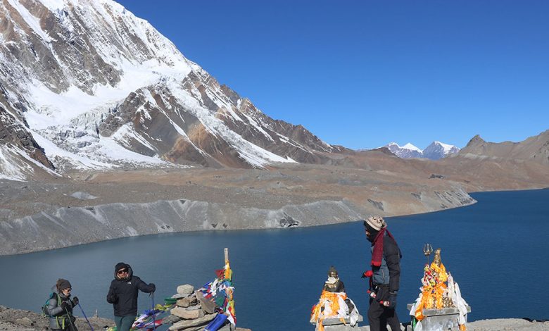
The potential risk posed by the Dona, or Thulagi, Glacial Lake in Manang has raised concerns about the safety of downstream areas along the Marsyangdi River. If a glacial lake outburst triggers a sudden major flood, its impact could travel from Manang through the Marsyangdi River to Lamjung, Gorkha and Tanahun, highlighting the need for regular monitoring, risk reassessment, an effective early-warning system and stronger disaster-response preparedness.
Located in Naso Rural Municipality–2 of Manang, Dona Glacial Lake has long been identified as potentially hazardous. Various studies have estimated the lake’s area at around 0.9 square kilometres, while a 2017 survey measured its maximum depth at 76 metres. As those studies are now several years old, a new field assessment is needed to examine changes in the lake’s area, water volume, glacier condition and surrounding geological structure.
Naso Rural Municipality–2 Ward Chair Ravi Gurung said the lake remains in a risky condition, although there is no indication of an immediate incident. According to him, the lake’s size has been changing and expanding compared with the past. The local government has been taking initiatives to reduce the risk, but significant funding is required for necessary protection measures, prompting requests for support from the provincial and federal governments.
Manang Chief District Officer Muktiprasad Khanal said it cannot be concluded that the lake will burst immediately, but the risk also cannot be ruled out. He said the accumulation of sand and soil around the lake has become a matter of concern and warned that the district’s existing resources could be insufficient if a large-scale glacial lake outburst flood occurs. Necessary initiatives have been taken with the National Disaster Risk Reduction and Management Authority to reduce the risk.
A possible flood could threaten not only settlements in Manang but also roads, bridges, hydropower projects and other important infrastructure along the Marsyangdi corridor. Lamjung Chief District Officer Krishnaprasad Khanal said low-lying areas around Sundarbazar, some parts of Besisahar and hydropower projects along the Marsyangdi corridor could also be affected.
Experts have said potentially dangerous glacial lakes should be monitored in the field at intervals of two to three years. Regular studies, identification of possible flood-flow zones, an effective early-warning system and stronger coordination among local governments and security agencies could help reduce human and physical losses. The risk from Dona Glacial Lake therefore needs to be treated not merely as an issue of the upper Himalayan region, but as part of the broader disaster-management planning for the entire Marsyangdi river corridor.