Chinese Scientists Complete Ozone Measurements Up to 8,861 Meters in Mount Qomolangma Region

Dragon Media News Desk
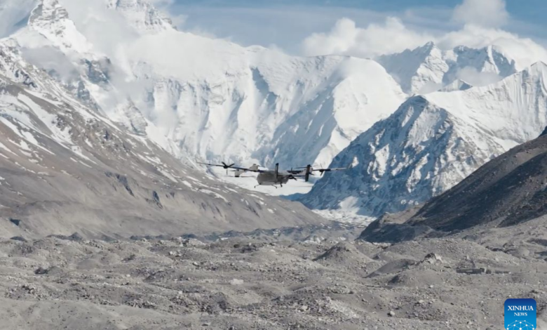
Chinese scientists have successfully measured the vertical distribution of ozone from the ground to an altitude of 8,861 meters in the Mount Qomolangma region. The measurement was carried out using an upgraded vertical take-off and landing fixed-wing hybrid drone and is being viewed as an important achievement in high-altitude environmental research.
A joint scientific team from Peking University and the Chinese Academy of Sciences conducted 12 days of field research on the northern slope of Mount Qomolangma in southwest China’s Xizang Autonomous Region. During the mission, the team completed 32 effective drone flights.
The drone crossed the altitude of 8,848 meters twice during the research period. In one of the flights, it reached a stable altitude of 8,861 meters while carrying scientific instruments, according to Ye Chunxiang, an associate professor at Peking University.
The team not only measured the vertical distribution of ozone but also observed the full process through which glacial winds transport ozone from the upper atmosphere down toward the ground. Scientists said the achievement provides direct evidence for studying high-concentration ozone and its changing patterns over the Qinghai-Tibet Plateau.
Ozone variation is considered an important indicator of atmospheric and environmental change. Because of its relatively clean atmospheric background, the Qinghai-Tibet Plateau is often regarded as a natural laboratory for understanding atmospheric changes across the Eurasian continent.
Previous studies had suggested that glacial winds could carry ozone from the upper atmosphere toward the Earth’s surface. However, systematic data on the spread of glacial winds, the ozone flow they carry and the direct atmospheric processes occurring in high mountain areas had remained limited. Such measurements had long been difficult because of technical limitations.
The research team worked with drone manufacturer DJI to upgrade the aircraft for high-altitude operations. The drone’s performance was improved to cope with thin air, major temperature differences and strong turbulent winds.
The new drone integrates the advantages of both multi-rotor and fixed-wing technologies. This allows it to take off and land vertically, maintain stable long-distance flight and carry scientific instruments for measurements under extreme high-altitude conditions.
According to the research team, special attention was given to the drone’s flight system, load-carrying capacity and data collection process to ensure the accuracy and representativeness of the data obtained at 8,861 meters.
The achievement is expected to support future drone-based scientific research in high mountain and extreme atmospheric environments.
Scientists believe the data will help deepen understanding of climate change, the high-altitude environment, long-distance pollution transport, glacial winds and atmospheric processes over the plateau.
The successful mission is also being described as a new step in China’s technical and scientific capacity to conduct environmental observation at extreme altitudes.